News
Introducing: future-proof ADCP technology from Nortek
Nortek is pleased to announce the launch of our upgraded Aquadopp and AWAC range of ADCPs. The latest versions of these instruments build on already existing capabilities loved by users for decades, and offer sleek user-friendly design, enhanced performance and future-proof internal components.
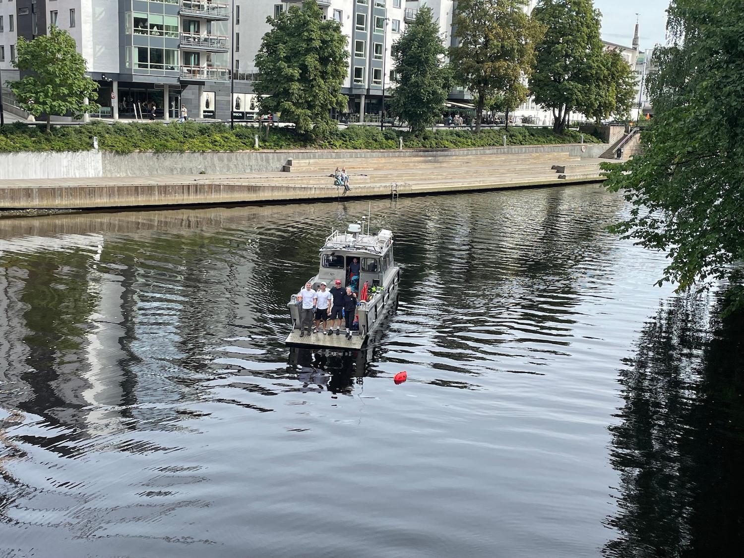
Second annual Nortek beach cleanup gathers 650 kg of trash from Sandvika river
This September, Nortek employees held their second annual underwater cleanup, this time removing litter from where a river meets the fjord in Sandvika, near Nortek’s HQ in Norway. With the help of local diver’s club Vollen Dykkeklubb and the Nortek boat, they successfully removed over 650 kg of trash from local waters.
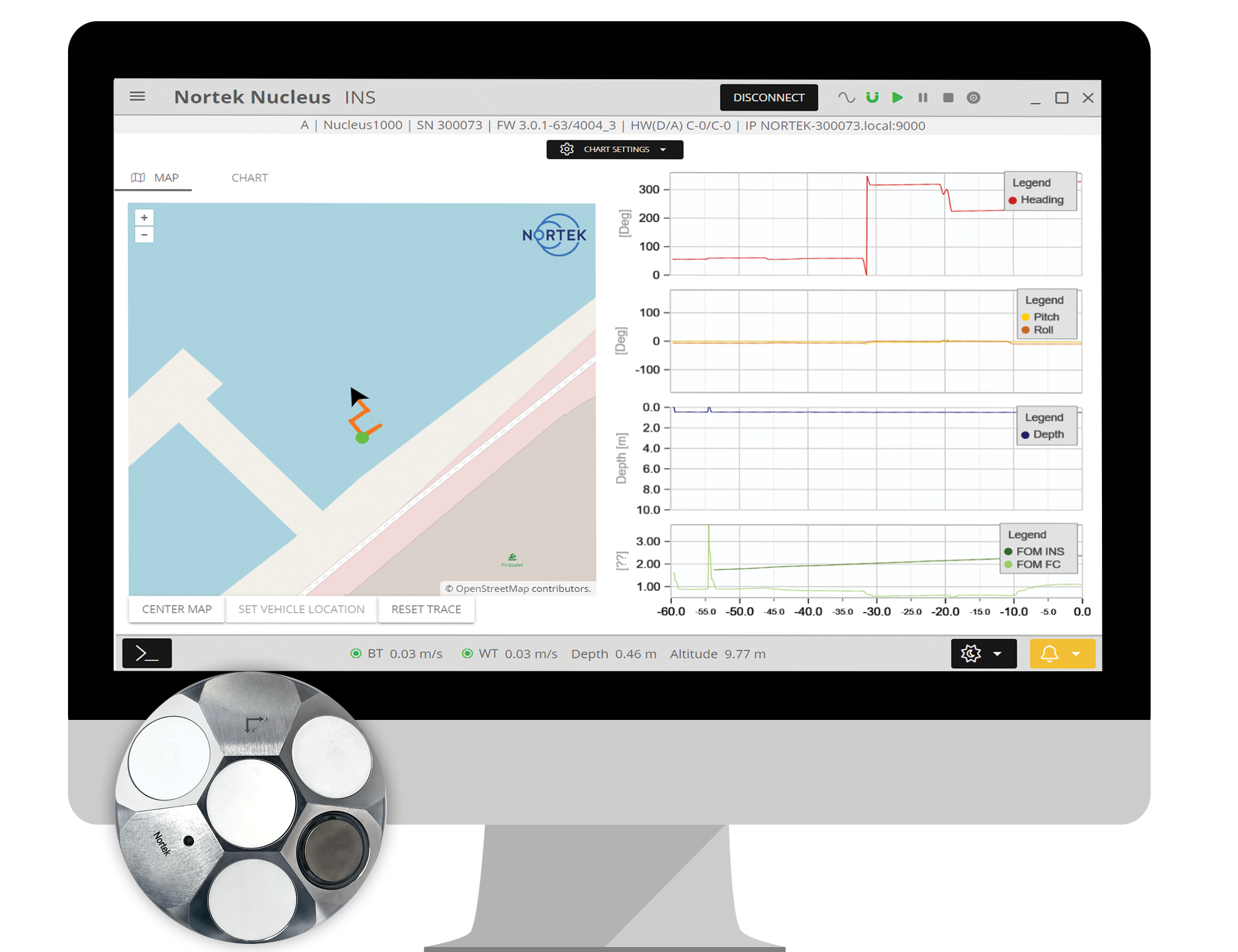
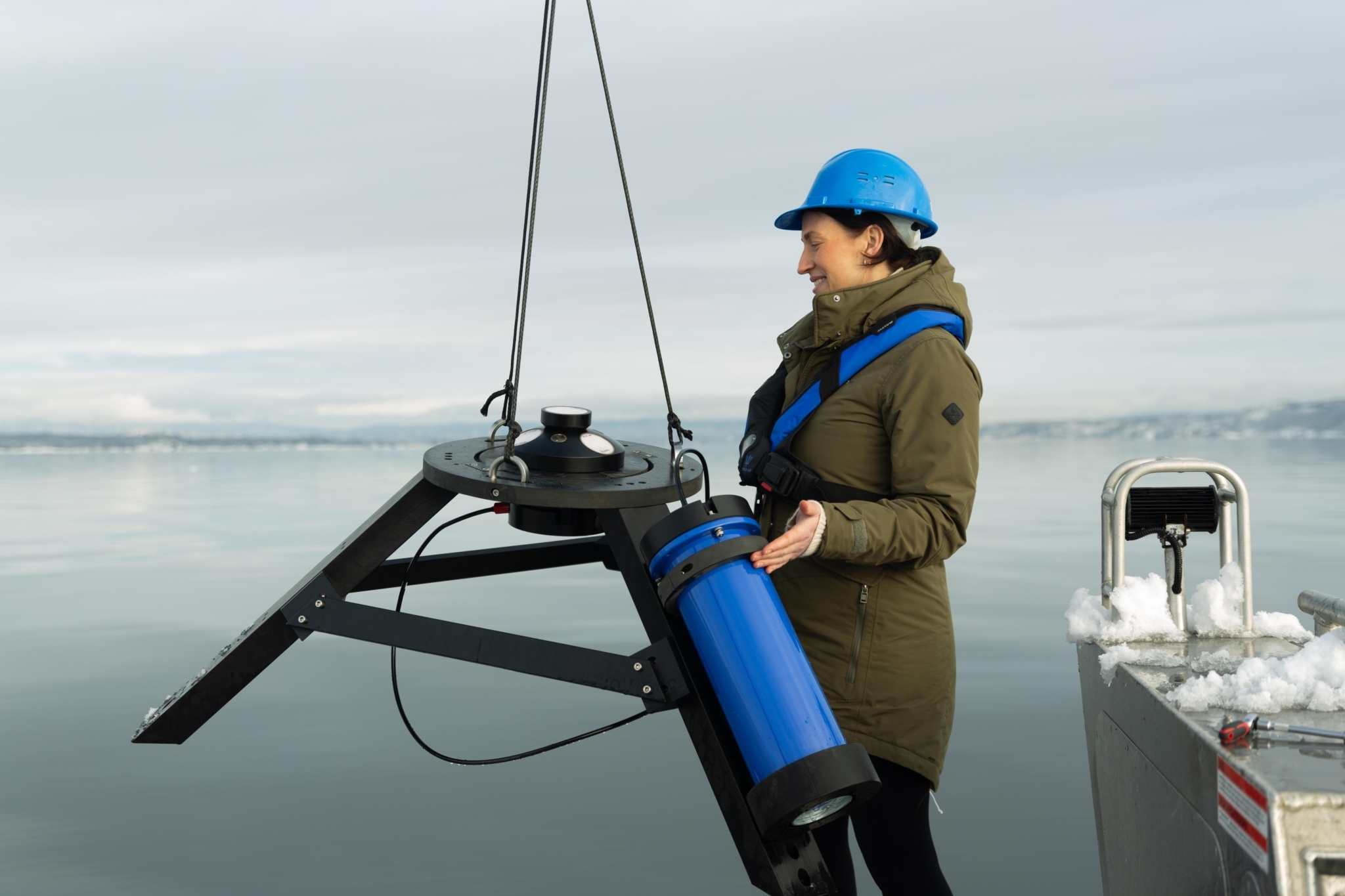
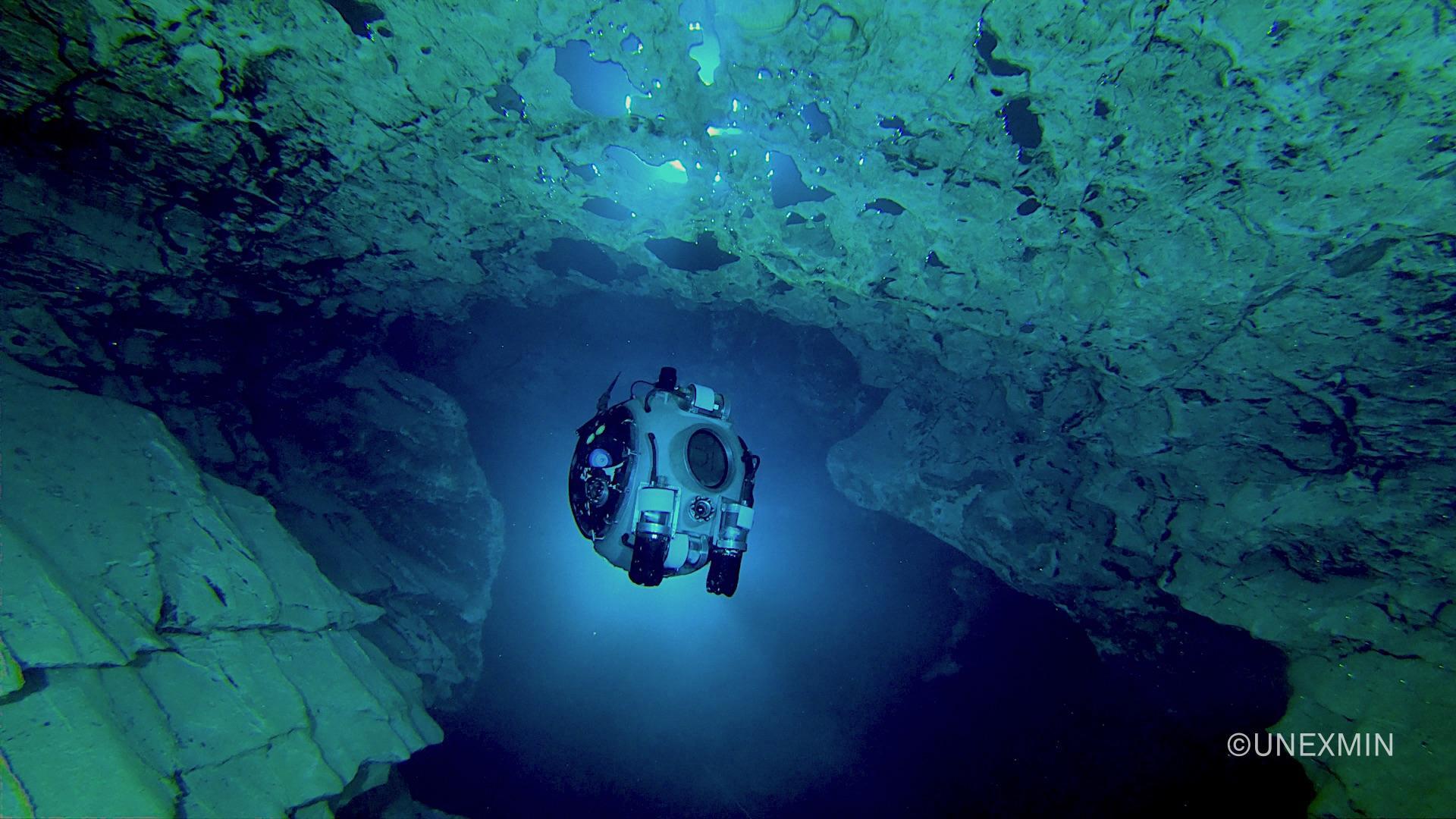
Integrated INS on Nucleus1000 for full navigation capabilities on small subsea vehicles
The Nucleus1000 navigation sensor suite is now available with full INS (inertial navigation system) capabilities, enabling absolute position outputs obtained using the Nucleus’s on-board inertial and acoustic sensor package.
Nortek Netherlands is hiring!
As our Netherlands office continues to grow and develop new and innovative vessel-mounted current measurement systems, it is seeking a Software Engineer, Support Engineer and Sales Engineer.
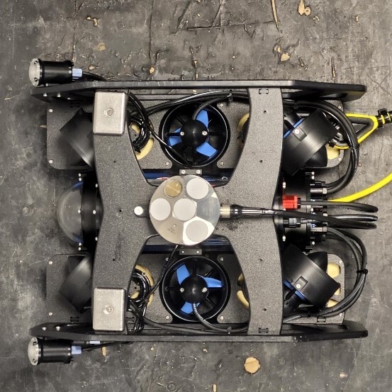
Updates to the Nortek DVL product line
You asked, we listened. Nortek is pleased to update you on the recent upgrades to our DVL range to ensure that we meet your needs in the best way possible. The following list provides an overview of the new features available with a spotlight on our DVL500 Compact.
Now available: Responsible Business Conduct statement
A full report describing our business conduct assessments is now available.
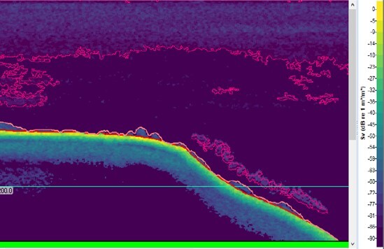
Using Echoview software with Signature ADCPs to get the most out of echosounder data
Some of Nortek’s Signature ADCPs offer an optional echosounder mode, allowing users to gather simultaneous current profiles and echosounder datasets. Visualization and processing of this echosounder data enables users to collect information about biomass, sediment or other objects in the water column. Find out how a partnership between hydroacoustic data specialists Echoview Software and Nortek makes quality data collection and visualization possible.
Integration of Nucleus1000 on a BlueROV2 opens doors for ROV users
New from Nortek support: integration tutorial for the Nucleus1000 navigation device with a BlueROV2.
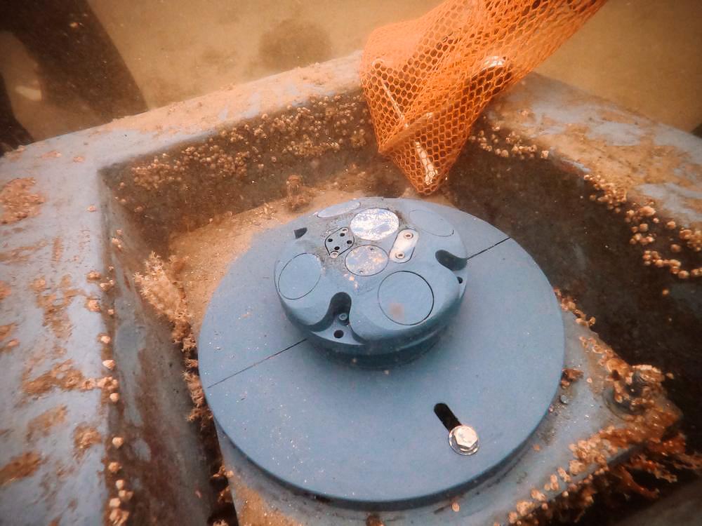
Next-level oceanographic customer service for the University of South Florida
Two Nortek sales advisors recently worked with a team at the University of South Florida to help recover and deploy four ADCPs as part of an oceanographic research project tracking pollution in Tampa Bay.
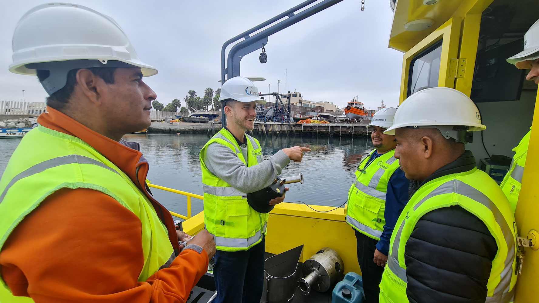
Nortek providing training for vessel-mounted ADCP applications in Peru
Nortek’s Renato Arruk recently helped maritime consultancy firm Canopus Marine Group strengthen their expertise by providing hands-on training for vessel-mounted current profilers (ADCPs) at a port in Lima, Peru. The training will help staff at Canopus maximize the operational potential of Nortek’s vessel-mounted system, while meeting the needs of Peru’s expanding maritime market.
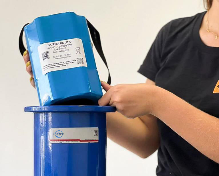
Implementing a sustainable ADCP battery disposal program in Brazil
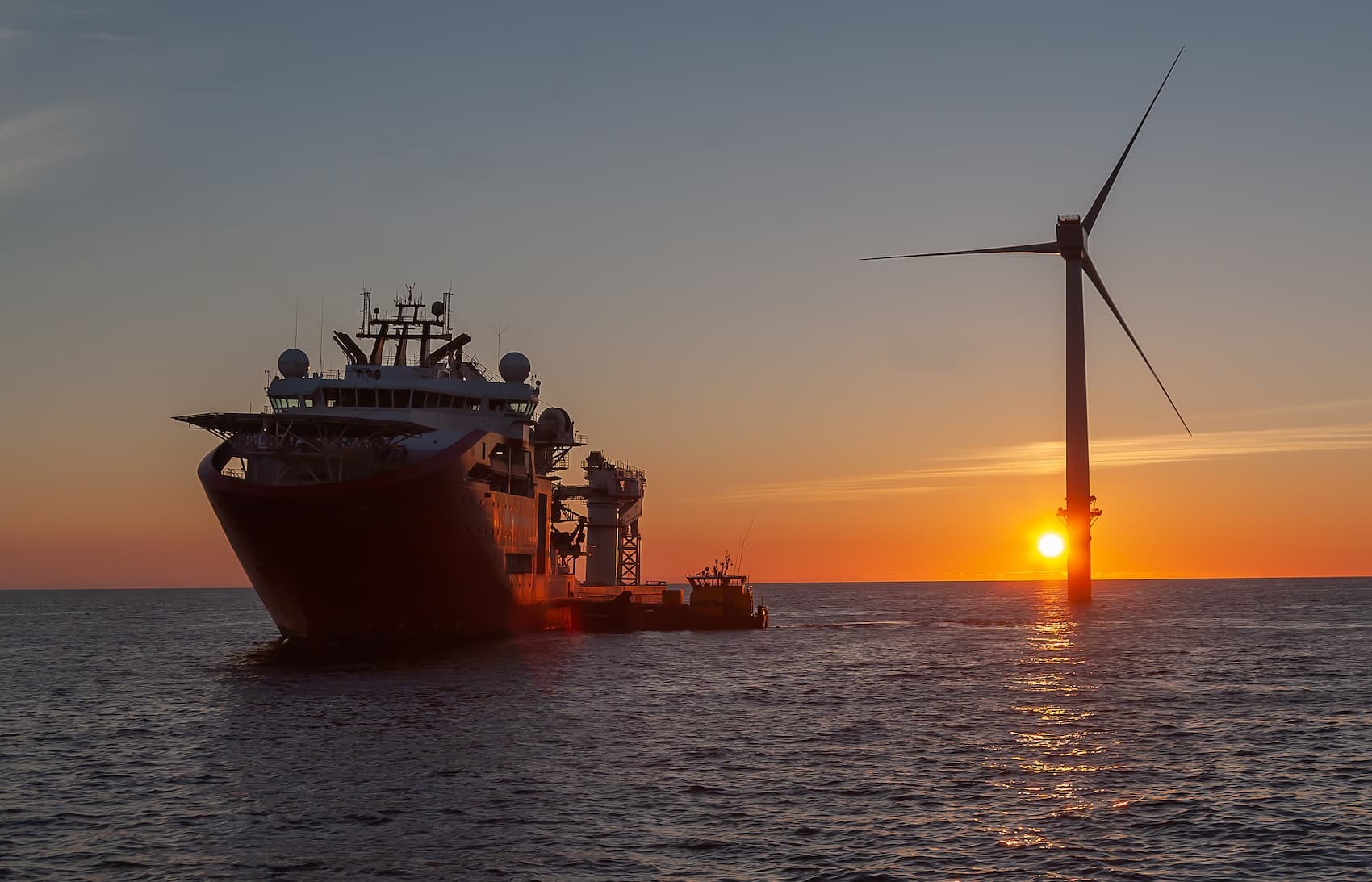
Introducing a pioneering solution for collecting operational current data
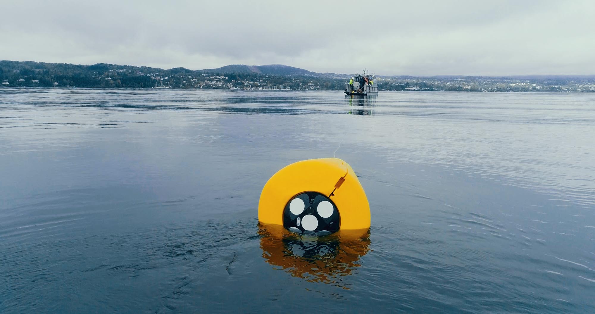
Nortek is proud to announce a new and modern vessel-mounted ADCP that provides reliable, real-time oceanographic data to support offshore operators making critical decisions.